How waterways shift
A model of the Waiapu River, based on 2018 LiDAR scanning, and 2022 satellite imagery . (PHOTO: Supplied)
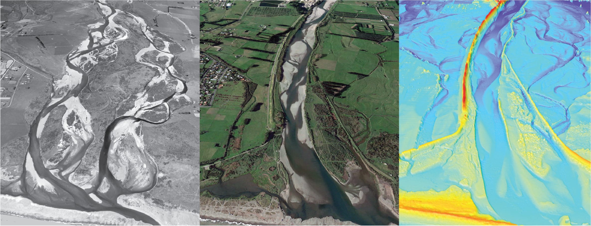
The Ōtaki River (Kapiti Coast) at the coast in 1939 (left), and at present (centre) (PHOTO: Supplied)
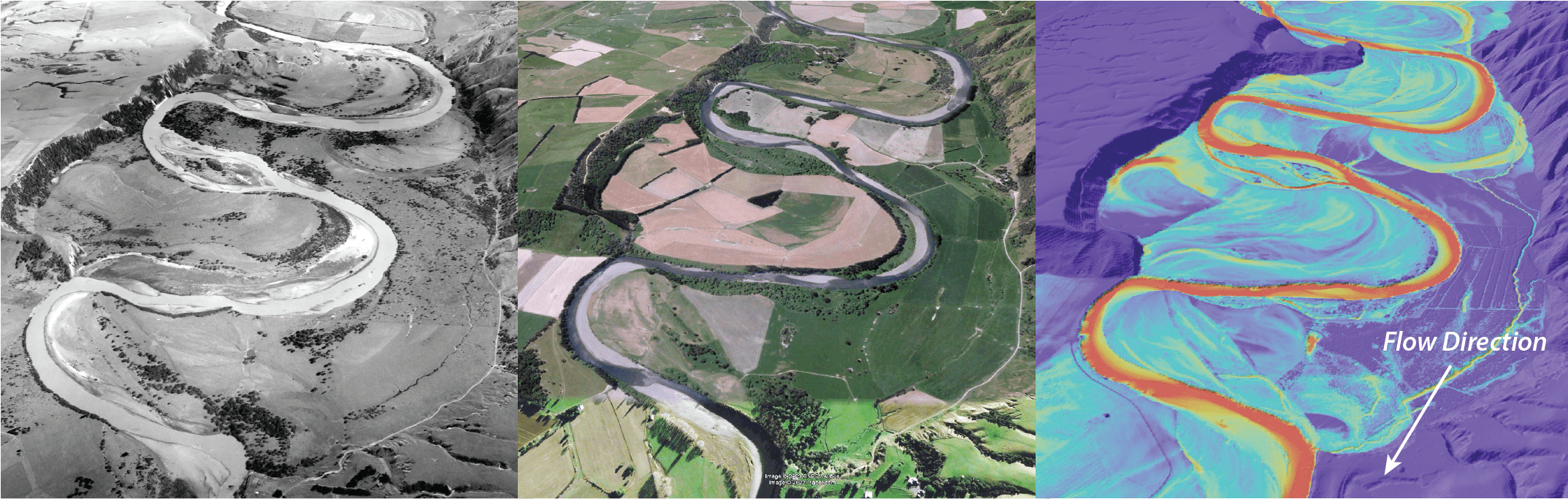
The Ruamahanga River in 1958, 2022 (left, centre) and in a 2018 LiDAR scan of the region. (PHOTO: Supplied)
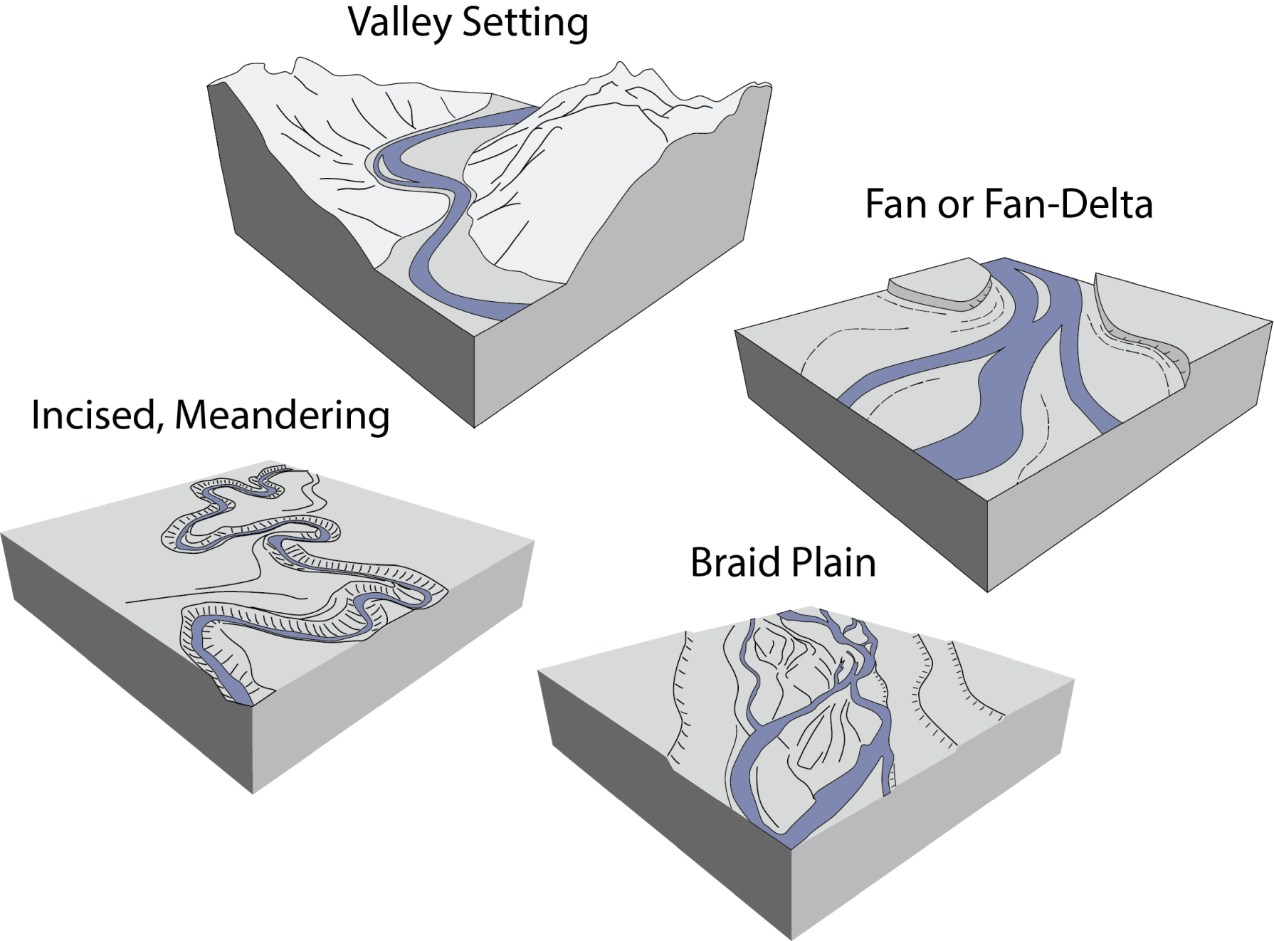
A river's geomorphic ‘setting’ is important and relates to the sediment supply from headwaters upstream (PHOTO: Supplied)
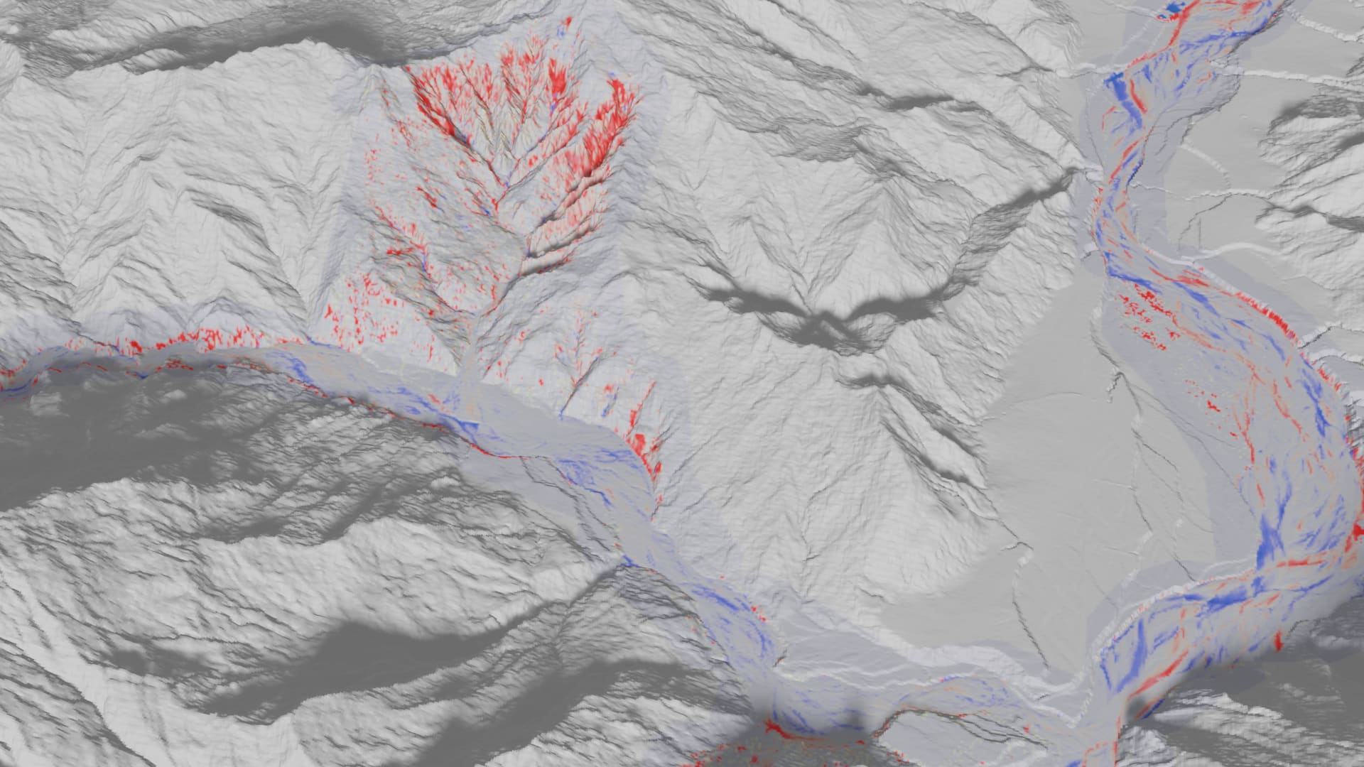
The pervasive influence of gully erosion on the Waiorongomai River (PHOTO: Supplied)
The images in this gallery are used with permission and are subject to copyright conditions.