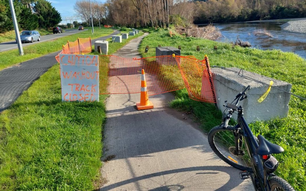
A path beside Te Awa Kairangi is closed by a ‘Caution, washout, track closed’ sign due to recent erosion on the east side of the river. The detour path and Harcourt Werry Dr are to the left. Photo: RNZ / Phil Pennington
The Hutt River has eroded a bank to within 20 metres of a major road just north of the city centre in Lower Hutt.
The regional council has been forced to shut a 100m section of a popular walking-cycling path and put in a detour alongside it.
It said it does not think the road, Harcourt Werry Drive, is at risk but was closely monitoring the spot on the eastern riverbank.
Greater Wellington expected four weeks of work to begin this month to recontour the riverbed as a short-term measure, with help from the Hutt City Council, environment group manager Lian Butcher said.
It needed permission to begin it under the Hutt River Flood Management Plan.
"This work will provide an interim solution," he said.
Long term, it aimed to protect the banks with major erosion work under the $700m Riverlink project that will take till 2027.
One of the signs closing the path reads on the front side 'Caution, washout, track closed', and on the back side reads 'Erosion control construction work' with a start date of June last year.
Butcher said last year they did erosion control further upstream on the west bank of Te Awa Kairangi.
This was "similar to the permanent work planned for RiverLink", with willows planted to catch and build up silt, then underplanted with natives.
In recent months the river has wiped out at least one of a series of pole-and-cable defences the willows are planted along, and at this point is only about 50m from the stopbank on which sits State Highway 2.