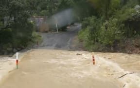
"Rototahi is now flooded and not passable. Waka Kotahi will be closing SH35 until flooding recedes", warns Uawa Civil Defence. Photo: Uawa Civil Defence - Tolaga Bay East Coast
The Coromandel's severe weather warning has been extended until 5pm Tuesday, as the area continues to be lashed by ex-Tropical Cyclone Lola.
As the storm moves towards Gisborne with the region under an orange heavy rain warning, Tologa Bay-based Uawa Civil Defence says State Highway 35 has closed due to flooding.
Earlier, flights and ferries were cancelled, and power was cut overnight to thousands in Northland and the Far North.
Some 71 homes in the Far North and 32 in Northland were still waiting for the lights to come back on by Monday evening - with Northpower saying some may not be restored until Tuesday.
Meanwhile, Hawke's Bay was forecast to receive up to 100mm of rain in the 24 hours from 8pm Monday, with peaks of up to 25mm/h expected on Tuesday afternoon and early evening with possible thunderstorms.
Coromandel
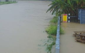
With several roads in Coromandel Peninsula closed, MetService warned heavy rainfall was expected to build after a lull, coinciding with the king tide about 9pm.
However, it downgraded expectations of rainfall volumes, saying between 60mm and 100mm was expected between 8pm Monday and 5pm Tuesday - less over a longer period than the up to 120mm by 9am previously forecast.
The earlier strong wind warning was also cancelled.
The region had already experienced about 220mm of rain by early afternoon - with peak rates of up to 25mm/h and severe gales up to 120km/h.
Residents in Matatoki, Puriri and Omahu are being asked to conserve water for up to 48 hours with heavy sediment causing problems for the water treatment plant. Half a dozen schools closed today as a pre-caution and a number of others opened late, with bus services cancelled.
The area is still recovering after being slammed during cyclone Gabrielle and other extreme weather events this year.
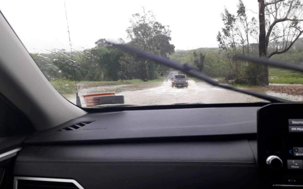
MetService said with another 200mm of rain expected for Coromandel tomorrow, more flooding and slips were possible and driving may be hazardous.
Coromandel MP Scott Simpson (National) told RNZ's Checkpoint these kinds of events did seem to be becoming more intense and more frequent.
"And if you think of the Coromandel Peninsula, most of our roads are coastal roads: they're windy, they're hilly, their geography is challenging at the best of times, so heavy weather events do have an impact."
He said National intended to keep the previous government's $6 billion resilience fund in place, so affected areas could receive funding for road resilience and shore up other services.
"There's not a lot more that we can do than allocate the funding that's required to make the infrastructure, the existing infrastructure, resilient. So that's our commitment and that's what we're going to do."
He said once the new government got to work he planned to make a strong case for more funding for Coromandel.
Tai Rāwhiti
Tai Rāwhiti was under an orange heavy rain warning until 7pm Tuesday, with peak rainfalls expected on Tuesday afternoon and early evening with possible thunderstorms.
MetService said Bay of Plenty and Rotorua could expect between 70mm and 100mm to accumulate between 8pm Monday and 7pm Tuesday, on top of what had already fallen, with peaks of 10mm/h to 20mm/h.
Gisborne was likely to see about 60mm to 100mm over the same time, but with slightly more intense falls of 15mm/h to 25mm/h.
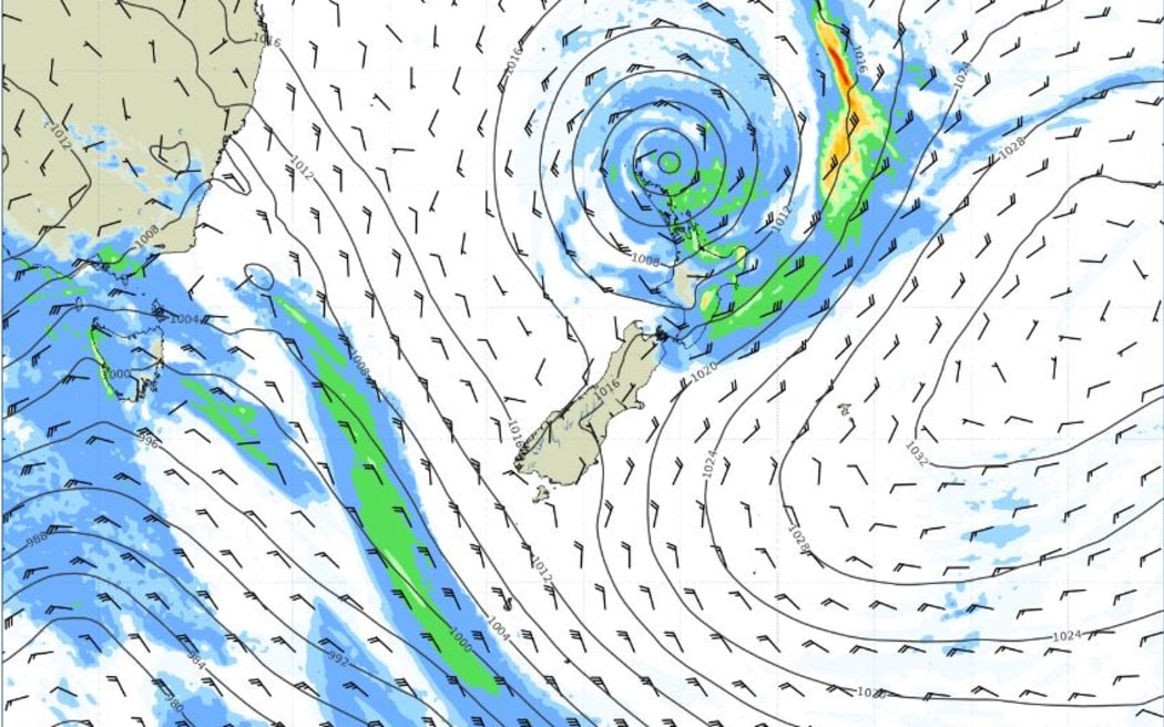
MetService forecasting shows the predicted track of ex-tropical cyclone Lola as it moves down towards Gisborne, about 1am Tuesday. Photo: Metservice
Uawa Civil Defence said SH35 had closed at Rototahi, which had become impassable, due to flooding.
"Stay home and hunker down for the night folks. No point in taking unnecessary risks," the group posted on Facebook.
Gisborne District Council confirmed Tapuaeroa Road off SH35 near Ruatoria had also closed at the 16km mark due to surface flooding.
Gisborne mayor Rehette Stoltz said council was getting more reports of flooding all the time, and was asking residents to tell them about weather-related problems, such as blocked culverts.
Tai Rāwhiti emergency management manager Ben Green told Checkpoint things in the area were "surprisingly tracking okay at this point".
"We've certainly been keeping a lens with what's coming through down from the north, but really just starting to see probably more effective rain coming in this afternoon, since about three o'clock."
He said surface flooding and a tree had come down to close State Highway 35, and he was not certain at that point whether it had reopened.
"Once we come into the evening hours, surface water in particular tends to be the thing that people don't see and that's why they ... may get into the middle of it, but at this stage we've got nothing that's significantly impeding our ability to move on our roads at present."
He said there were no sign of landslips yet, and no concerns for stock or people.