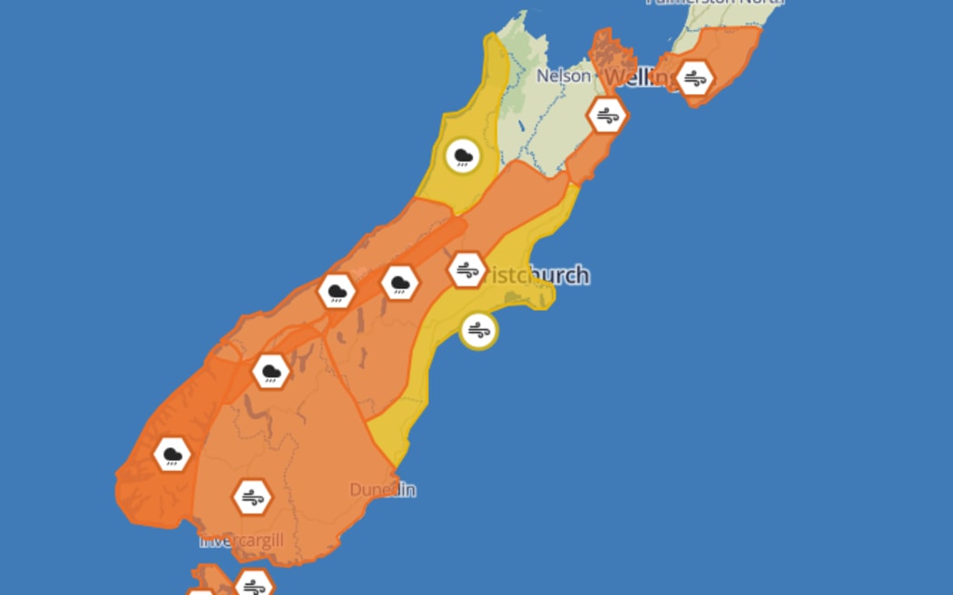
MetService weather warnings and watches as at 8:30pm on Saturday 9 December, 2023. Photo: Supplied/MetService
MetService weather warnings and watches as at 8:30pm on Saturday 9 December, 2023.
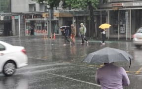
Severe heavy rain and gale warnings have been issued for parts of the lower North Island and much of the South Island, from Saturday into Sunday.
MetService said winds up to 130kph were expected, and up to 160mm of rain for some places.
It urged people to keep up to date with their latest forecast updates, including on their warnings and watches page.
Winds up 120 and 130kph forecast
An orange warning for gale force winds was set for Wellington, Wairarapa, southern parts of Tararua District, the Marlborough Sounds and the Kaikōura coast and ranges, for the period from 10pm Saturday until midday Sunday, MetService said.
People in those areas should expect "severe gale northwesterlies, gusting [to] 120kph in exposed places". However, the winds could gust even higher in Wellington on Sunday morning, with speeds to 130kph possible.
Severe gales could damage trees, powerlines and unsecured structures. While driving could be dangerous, especially for high-sided vehicles and motorcycles, the weather service warned.
In Canterbury, an orange wind warning was in place for the high country, where severe northwester gales could also be expected "with damaging gusts of 130kph in exposed places," until 6am Sunday.
A yellow severe wind watch was in place for Christchurch and the Canterbury plains and North Otago, where the winds could approach severe gales in exposed places, especially in the Banks Peninsula area, until the early hours of Sunday.
And in South Otago, Southland, Stewart Island and Fiordland, severe northwesterlies were expected, gusting to 120kph in exposed places from 8pm until late on Saturday.
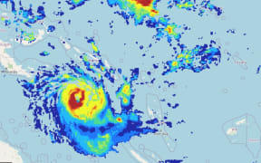
Satellite-eye-view for keen cloud watchers
— MetService (@MetService) December 9, 2023
As the front at the bottom of the South Island continues northwards, it will bring heavy rain to the West Coast and Southern Alps, while eastern regions experience blustery winds - see https://t.co/qHyE5zzql5 for more info
☀… pic.twitter.com/c5i2882VEX
Heavy rain forecast
Heavy rain was forecast for Westland, Fiordland, the Canterbury High Country, and the headwaters of Otago lakes and rivers, from 8pm Saturday until the early hours of Sunday.
By 8:30pm on Saturday, the largest amount of rainfall expected in that timeframe was up to 160mm for Westland from the glaciers southwards and about the ranges, but the coast north of the glaciers could get up to 100mm.
"Heavy rain may cause streams and rivers to rise rapidly. Surface flooding and slips are also possible and driving conditions may be hazardous," MetService said.