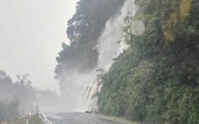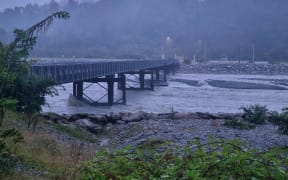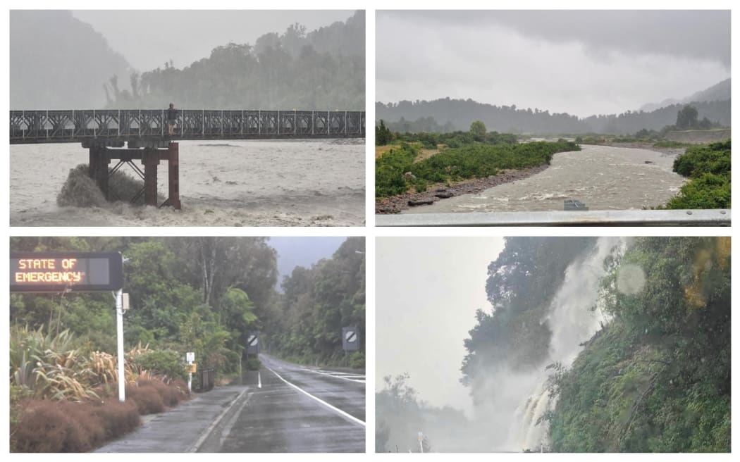
From top left: A spectator on the Waiho bailey bridge on SH6, near Franz Josef; the Tatare River near Franz Josef as seen from SH6; Roaring Billy Falls in Haast Valley and the state of emergency sign in Fox Glacier. Photo: RNZ / Tess Brunton / Martin Gibson
Residents in parts of Westland have been told to prepare to move at short notice, as torrential rain continues, and the worst yet to come.
A local State of Emergency has been declared for Westland between Hokitika and Haast.
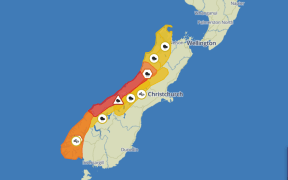
Westland remains under a red heavy rain alert until 8am Saturday, with another band of heavy rain due to hit from 10pm.
Heavy rain is expected to ease in the south tonight then further north during Saturday morning, MetService said.
In an 8.30pm update, MetService said on top of what had already fallen, 150mm-250mm of rain was expected to accumulate about the ranges, and possibly more in localised areas. It expected 40m-100mm of rain about the coast.
The Grey District is under an orange heavy rain warning until 9am Saturday with peak hourly rates of 25mm-30mm expected, especially Saturday morning.
The headwaters of Canterbury lakes and rivers from Arthur's Pass southwards are under a orange heavy rain warning until 6am Saturday.
"On top of what has already fallen, expect 100 to 200mm of rain near the Divide, with 50 to 100mm of rain spreading 15 km east of the Divide. Rainfall rates near the Divide could reach 20 to 30mm/h," MetService said.
SH6 from Ross to Makarora is closed and will remain closed overnight.
Earlier on Friday evening, West Coast Emergency Management said the expected rain would likely cause dangerous river conditions and significant flooding.
Slips and floodwaters were likely to make some roads impassable and could isolate communities, it said on Facebook.
Mayor Helen Lash said no evacuations had been necessary as of 8pm.
Though residents were being told to be prepared to move at short notice, as torrential rain continues, and the worst yet to come.
The Waiho River in Franz Josef is expected to peak around 2am, with the Hokitika River expected to follow around 10am.
High tide in Hokitika would be around 7am Saturday.
The rivers are being closely monitored overnight and Lash said if there was any risk to people, they will be advised to move accordingly.
Civil Defence has advised locals to stay home while guests staying in motels and hotels have been told to stay put.
Earlier, people camping near waterways were told to pack up and head to the nearest township for safe and secure accommodation.
Civil Defence will advise when the State of Emergency is lifted.
Overnight road conditions can be found on the Waka Kotahi NZTA website.
Minister for Civil Defence Mark Mitchell travelled to the West Coast this evening.
Staying safe
West Coast Emergency Management has issued some guidelines for locals on how to stay safe if Friday's bad weather causes flooding.
- Put safety first.
- Don't take any chances. Act quickly if you see rising water.
- Floods and flash floods can happen quickly. If you see rising water do not wait for official warnings. Head for higher ground and stay away from floodwater.
- Stay out of flood water
- Never try to walk, swim or drive through flood water. Many flood fatalities are caused by people attempting to drive through water.
- Always assume that flood water is contaminated with farm run-off, chemicals and sewage. Contaminated flood water can make you sick.
- Make sure you wash your hands, clothes and property after contact with flood waters.