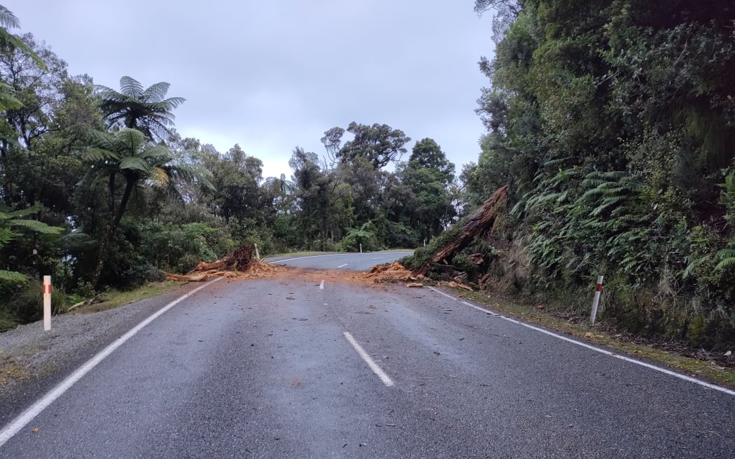
A tree across SHW 6 on Wednesday at 4pm - 1km south of Irimahuwhero Point on the Coast Road - just north of Punakaiki. Photo: Supplied / Richard Arlidge
The West Coast is set to get the worst of the torrential rain that has been drenching parts of the region.
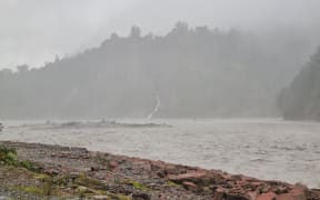
MetService said up to 450mm of rain hit Westland on Wednesday and another 350mm is forecast by 9pm on Thursday.
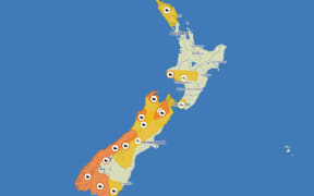
There are eight orange heavy rain warnings in the South Island, and parts of the North, which is forecast to be hit by a front also bringing strong wind overnight on Thursday.
Have you got photos of the weather's impact to share? Email RNZ at iwitness@rnz.co.nz
The Waiho River at Franz Josef and the Hokitika River in the Hokitika Gorge have crossed alert thresholds.
RNZ is New Zealand's statutory civil defence lifeline radio broadcaster, providing vital information and updates as they come to hand.
Check out the frequencies here.
The National Emergency Management Agency (NEMA) advises that in times of crisis or civil defence emergency a battery powered radio or a car radio remain essential lifelines if power is out and other forms of communication are unavailable.
Follow Thursday's weather updates with RNZ's blog: