
Photo: Christchurch City Council
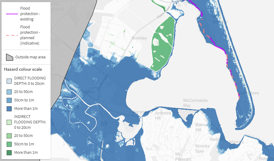
Christchurch and Banks Peninsula residents can go on line from Friday to find out how vulnerable their properties are to coastal erosion. It's part of Christchurch City Council's efforts to engage residents in moves to adapt coastal and low-lying areas of the city and the peninsula in line with predicted sea level rises. It's anticipated the digital tool will give residents information so they can be part of this conversation.
Using data from a Coastal Hazard Assessment report by environmental and engineering consultancy Tonkin and Taylor , residents will be able to see how coastal flooding, erosion and groundwater levels could affect their properties from now until the middle of the century, through a colour coding system. Data suggests parts of Christchurch and Banks Peninsula are likely to become uninhabitable by 2050. Council principal programme advisor Jane Morgan speaks with Kathryn Ryan.

