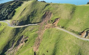
New research has mapped the slips that occurred in the Marlborough Sounds after flooding in 2021 and 2022. Photo: Waka Kotahi via LDR
A majority of the near 8000 landslides in Marlborough's severe rain events happened where "humans have been messing with the land", new research has found.
And despite "indigenous forest" making up nearly half the vegetation in the Marlborough Sounds, and copping some of the heaviest rain, landslides in these areas were "under-represented" after the flooding in 2021 and 2022.
The findings have prompted a council staffer and councillors to call for more research so a policy can be developed to manage the risk of landslides.
Following the severe flooding in Marlborough in July 2021 and August 2022, GNS Science mapped the distribution of landslides across the Marlborough Sounds and visited some properties to assess damage.
Off the back of that research, a report prepared by Marlborough District Council soil scientist Matt Oliver said in both storms, the greatest number and density of landslides did not occur in the areas that received the highest rainfall.
Nearly 4000 landslides were mapped after each of the storms.
Data from 2021 showed 35.5 percent of landslides were triggered in harvested exotic forest, 28.7 percent in exotic plantation forest, 10.4 percent in broad-leaved indigenous hardwood, 6.1 percent in low-producing grassland and 6 percent in high producing exotic grassland.
In 2022, 28.3 percent of landslides were triggered in high-producing exotic grassland, 18.6 percent in broad-leaved indigenous hardwood, and 13.1 percent in mānuka/kānuka. Exotic forest accounted for 8.9 percent and harvested forest for 5.9 percent of landslides.
"The differences between impacts of the two storms illustrate how difficult it is to attribute slope failure to single causal factors," the report said.
"The storms occurred across different locations, at differing intensities, total rainfall, and timing.
"The differing locations led to differences in local geology and land use. However, what seems clear from these data is that landslide density cannot be solely attributed to rainfall alone."
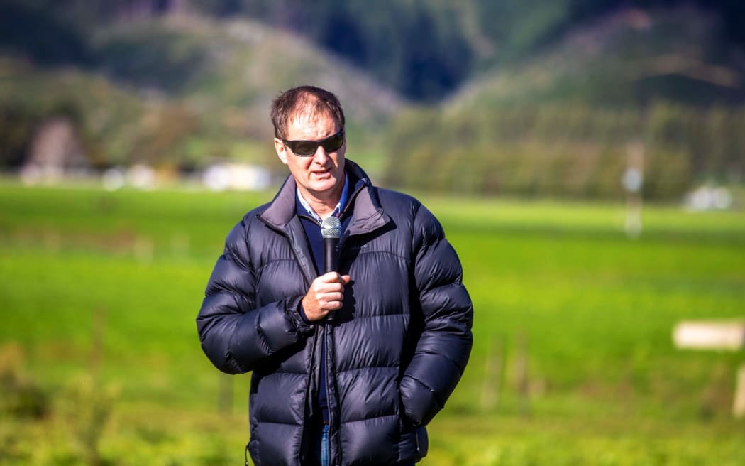
Marlborough District Council soil scientist Matt Oliver says indigenous forest prevents landslides better than exotic. Photo: Stuff via LDR
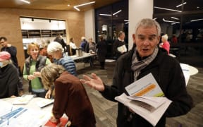
Speaking to councillors at an Environment and Planning committee meeting this month Oliver said the "problem" was forestry and human interaction with the land.
"Let's just get it out there," he said.
"Harvest forest and exotic forest makes up around about 18 percent of the land cover (in 2021), yet it contributed something in the order of 65 percent of the landslides.
"The rain didn't fall evenly. It fell everywhere, it fell most heavily on the indigenous forest, and it fell most heavily on the highest slopes, yet those are under-represented."
He said the data showed that indigenous forest made up close to 50 percent of the land area.
"Yet it's only contributing maybe 5 percent of the landslides," he said.
"That's something we understand intuitively. What these graphs are showing us is that human induced land use is the problem here."
Humans were the "dominant factor", he said.
"Landslides occurred most heavily where humans have been messing with the land," he said.
"That's a very crude way of putting it. But scrub is regenerating land of old pasture, we have pasture, exotic forest, forest harvesting. They all contribute hugely to the landslides."
He said the damage had been significant.
"When you go and view these things, and you look in the windows that have been pushed in, and see the kids' cots that have been pushed against the wall by mud, it is very hard not to be moved by the risks these things pose to people, the risk these pose to infrastructure, and the risk these pose to the environment," he said.
Further "multi-variate" analysis was needed Oliver said, which in turn would lead to new policy.
"There are too many risks here.
"With climate change, and increasing likelihood of more of these storms, we will only see more damage, and more risk.
"My great fear at night when I see a 100mm rainfall forecast for the Marlborough Sounds is that some members of our community may not make it through that storm event, and I don't wish to see that happen."
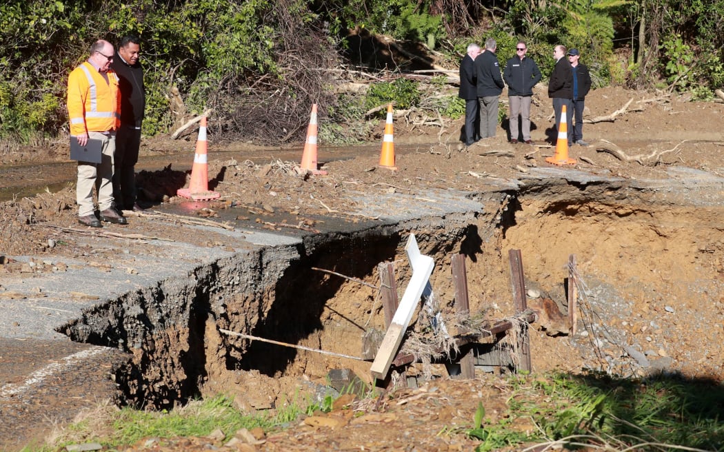
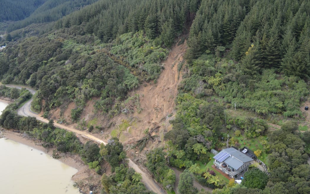
Nearly 4000 slips have been mapped after the 2020 and 2021 floods. Photo: Stuff
Environment and Planning committee chair and Wairau-Awatere councillor Gerald Hope said the report was "really important".
"It's benchmarking where we are," Hope said.
"But it does raise issues for future consenting and how we actually proceed with Sounds developments. So it's significant in its context."
The committee approved a recommendation that the council included an "assessment of landslide risks" in the Marlborough Sounds into its natural hazards programme.
This could "better coordinate" research into all the natural hazards likely to be faced by the council in the future.
Local Democracy Reporting is Public Interest Journalism funded through NZ On Air