
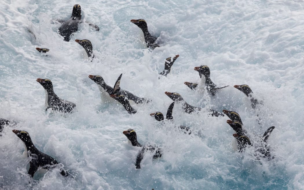
A raft of erect-crested penguins make the bull-rush to shore on Proclamation Island, part of the Bounty Island group. Photo: © Richard Robinson
Follow Voice of Tangaroa on Apple Podcasts, Spotify, iHeart or wherever you get your podcasts.
The Bounty Islands jut out of the water like giant granite fins. Steep and sheer, with no greenery in sight. They are covered instead by a mottled white – guano or bird poo from the tens of thousands of penguins and albatrosses that come here to breed.
The least studied penguin
The Bounty Islands is one of two remote, subantarctic island groups home to the erect-crested penguin. Stout and handsome, with bright yellow crests that look like elaborate punk rock hairdos, their remote breeding sites means they’ve not been studied in depth.
But Dr Thomas Mattern of the Tawaki Project plans to change that.
Good news and bad
Using drones to make photo mosaics of all the Bounty islands, Thomas has counted each penguin breeding pair and arrived at a number that suggests the Bounty Island population of penguins has remained relatively stable since the mid-1990s. Good news.
Not the case for their other breeding sites at the Antipodes Islands, where early evidence suggests a significant decline.
But these island groups are a mere 200 kilometres apart – a hop, skip and a jump in penguin swimming distance. How is one group seemingly doing fine while the other is in trouble?
New Zealand Geographic’s James Frankham joins an expedition to these remote and wild islands as the scientists begin to unravel this mystery.
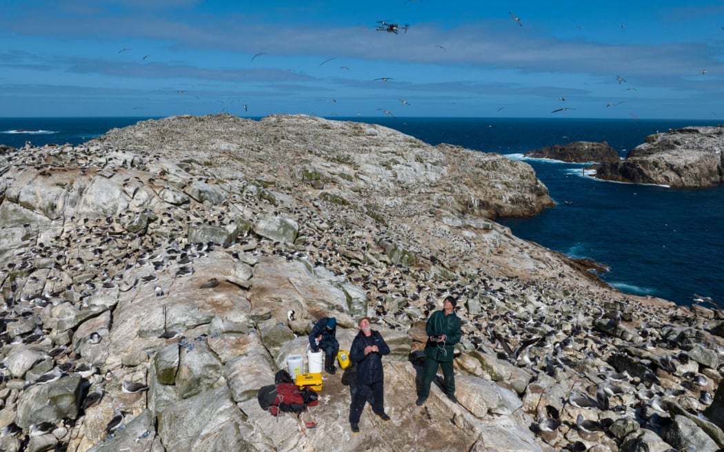
At the summit of Proclamation Island, part of the Bounty Islands, Otago University scientist Thomas Mattern launches a drone through ‘the albatross layer’ that swarms the island, with Dave Houston acting as an air traffic controller. Mattern (and his daughter Hannah who flew a second drone) took 8,145 photos on 44 white-knuckled flights to map and model the entire island group; data he will use to count every single bird that nests here. Photo: © Richard Robinson
Learn more:
-
Read the accompanying New Zealand Geographic article by James Frankham, with photography by Richard Robinson.
-
Listen to previous episodes of Voice of Tangaroa.
-
As part of this expedition Claire Concannon also visited the Antipodes Islands to learn how they have fared since mice were eradicated.
Photo: NZ On Air
Voice of Tangaroa is a joint production between RNZ’s Our Changing World and New Zealand Geographic.
Reporting for this series is Public Interest Journalism funded through NZ On Air. You can learn more and read the articles for free at www.nzgeo.com/seas

